

Bricklieve Mountains [An Bricshliabh]
Good walks are even better shared.
G7511 : Lower cairns at Carrowkeel
John M Photo source
Overview
Bricklieve Mountains [An Bricshliabh]
Overview
The Bricklieve Mountains, known as An Bricshliabh in Irish, stand proudly at 590 meters in the serene Sligo region of Ireland. This hidden gem is an ideal destination for hikers looking for a moderate trek with stunning views, beautiful landscapes, and a tantalising sprinkle of history and culture.
Geology
Composed primarily of sandstone and limestone, the Bricklieve Mountains offer unique geological features that speak of centuries of natural processes. From ancient seabeds to interesting rock formations, the geological diversity ensures every step unveils a story from the Earth’s past.
Routes
Bricklieve Loop
- Distance: 9 km
- Time: Approximately 3.5 hours
- Difficulty: Moderate
This circular route is perfect for those looking to explore the mountains’ grandeur without getting lost in the wilderness. Trail markers guide you through various terrains, from grassy hills to rocky outcrops.
Summit Features
At the top, adventurers will find a rocky outcrop adorned with a sturdy stone cairn. This spot isn’t just for resting your weary legs; it’s a photographer’s dream with its breathtaking views in every direction.
Terrain Type
Expect a thrilling mix of grassy slopes, rocky paths, and, at times, boggy patches that may surprise unsuspecting hikers. This means proper footwear is essential; leave those flip-flops at home!
Views
The views from An Bricshliabh are nothing short of spectacular. On a clear day, marvel at the expansive Lough Arrow and the rolling Sligo countryside. With a bit of luck, Benbulben may even make an appearance in the distance.
Best Seasons
The best time to explore this mountainous wonderland is during spring and autumn when nature splashes colour across the landscape and the weather is relatively stable.
Hazards
Remember, the British weather can be as unpredictable as a cat on a hot tin roof. Be wary of sudden changes, and always check forecasts before embarking on your adventure.
Nearby Summits
If you've got the legs for it, nearby peaks include Knocknarea and Benbulben, both offering their unique set of challenges and rewarding views.
Access
Nearest Parking
The best parking can be found in Killarney village, where you can leave your car securely located near the trailhead.
Public Transport
Local bus services connect Sligo City to Killarney, making it accessible for those who prefer public transport. However, a car helps you make the most of your hiking adventures.
Nearest Town
Ballymote, about 15 km away, is the nearest significant town where amenities are available.
Facilities
Local facilities are limited within the mountains themselves, but head into Ballymote for cafes and places to refresh yourself and attend to the necessities before or after your hike.
History
Name Meaning
'An Bricshliabh' directly translates to 'the mountain of the stones,' referencing the rocky nature that is emblematic of this beautiful region.
Significance
Historically, the Bricklieve Mountains are home to ancient settlements, with artefacts suggesting they were part of the Neolithic and Bronze Age cultural landscapes.
In conclusion, the Bricklieve Mountains provide a delightful combination of stunning vistas, interesting geology, and a dose of local history. Whether you’re scaling to the summit or just enjoying the lush surroundings, An Bricshliabh is a place that won’t be forgotten in a hurry. Happy hiking!
Explore routes near Bricklieve Mountains [An Bricshliabh]
Walks starting near this hill. Open a route to check its map, distance and full itinerary.
Route planning notes
These notes describe possible approaches. Check a route's map and access information when planning your walk.
Bricklieve Loop
A stunning circular route that takes you around the scenic Bricklieve Mountains, including the ascent to the summit of An Bricshliabh.
Make a day of it, together
Find someone to share the walk with, or organise a day out along a route you like.
Photo Gallery
View all Photo could not load
G7511 : Lower cairns at Carrowkeel
John M
 Photo could not load
G7511 : Stone Mounds
kevin higgins
 Photo could not load
G7511 : Passage Tombs, Carrowkeel: aerial 2003
Chris
 Photo could not load
G7511 : Carrowkeel Passage Tomb
John M
 Photo could not load
G7511 : Burial Mounds
kevin higgins
 Photo could not load
G7511 : Chamber Entrance
kevin higgins
 Photo could not load
G7511 : Inside a passage tomb at Carrowkeel
John M
 Photo could not load
G7511 : Passage tombs, Carrowkeel: aerial 2003
Chris
 Photo could not load
G7511 : Entering a passage tomb at Carrowkeel
John M
 Photo could not load
G7511 : Carrowkeel passage tombs: aerial 2003
Chris
Hill facts and local notes
Classifications
Elevation
321m
1,053 ft
Prominence
173m
Coordinates
54.0540, -8.3779
G753117
OS Map
25
At the Summit
The summit of An Bricshliabh features a distinct rocky outcrop and a small stone cairn, providing a perfect spot for a selfie against the backdrop of breathtaking views.
Terrain & Geology
The Bricklieve Mountains are primarily composed of sandstone and limestone, offering a glimpse into the geological history of the region. The rock formations are a testament to the ancient seabeds that once covered this area.
Views & Scenery
From the summit, enjoy panoramic views of Lough Arrow, the Sligo countryside, and if you're lucky, a glimpse of Benbulben in the distance.
History & Heritage
Name Origin
The name 'An Bricshliabh' translates to 'the mountain of the stones' in Irish, hinting at the rocky terrain that hikers will encounter.
Historical Significance
This mountain range has historical significance dating back to ancient times, with evidence of Neolithic and Bronze Age settlements in the area.
Getting There & Facilities
Parking
There's a convenient parking area at the base of the mountains near the village of Killarney, which can accommodate around 10 vehicles.
Public Transport
Local buses run from Sligo City to Killarney, although a car may be more convenient if you want the full hiking experience.
Nearby Facilities
While facilities are sparse in the wilderness, local cafes can be found in Ballymote, providing refreshments and toilets before or after your hike.
Safety Information
Known Hazards
- Beware of sudden weather changes, as the British weather loves to play tricks. Always check forecasts before setting out.
General Safety Tips
- Check weather conditions before setting out
- Carry appropriate clothing and equipment
- Let someone know your planned route
- Take a map, compass, and GPS device
- Carry emergency supplies: food, water, first aid kit, torch
Hills
Some common questions about the hills answered
Are there group walks up Bricklieve Mountains [An Bricshliabh]?
Many walkers use Walkmates to join or organise walks with others. You can check for group walks around Bricklieve Mountains [An Bricshliabh] through the maps
Are there other walkers around Bricklieve Mountains [An Bricshliabh]?
Activity varies by location and time, but Walkmates lets you see whether others have shared walks or shown interest in this area. Find other people through the walking friends search walking friends for Bricklieve Mountains [An Bricshliabh] search or of course create your own walk for Bricklieve Mountains [An Bricshliabh]
Can I organise a walk to Bricklieve Mountains [An Bricshliabh]?
Yes. If there aren’t any walks listed already, you can create a walk and make it available for others to join.
If you're signed up to Walkmates, you can create a walk to Bricklieve Mountains [An Bricshliabh].
How do I find a walk up this hill?
There are often multiple ways to walk this hill, depending on experience and route preference. Walkmates helps you explore walks and routes that others have shared.
Can I suggest a new route up Bricklieve Mountains [An Bricshliabh]?
Yes. You can suggest or create routes to share with others. Walkmates focuses on the social side of walking, so routes are used to help people organise walks and explore areas together, rather than as detailed navigation tools or route libraries.
Other uses really appreciate knowledgeable walkers sharing their routes. Share your favourite route to Bricklieve Mountains [An Bricshliabh] here
The is an error or something incorrect about this hill. How do I let you know?
We always strive to keep the information on Walkmates as accurate as possible. If you find an error, please let us know through the contact form and we'll aim to correct it as quickly as possible
Community Discussion
Comments
Location
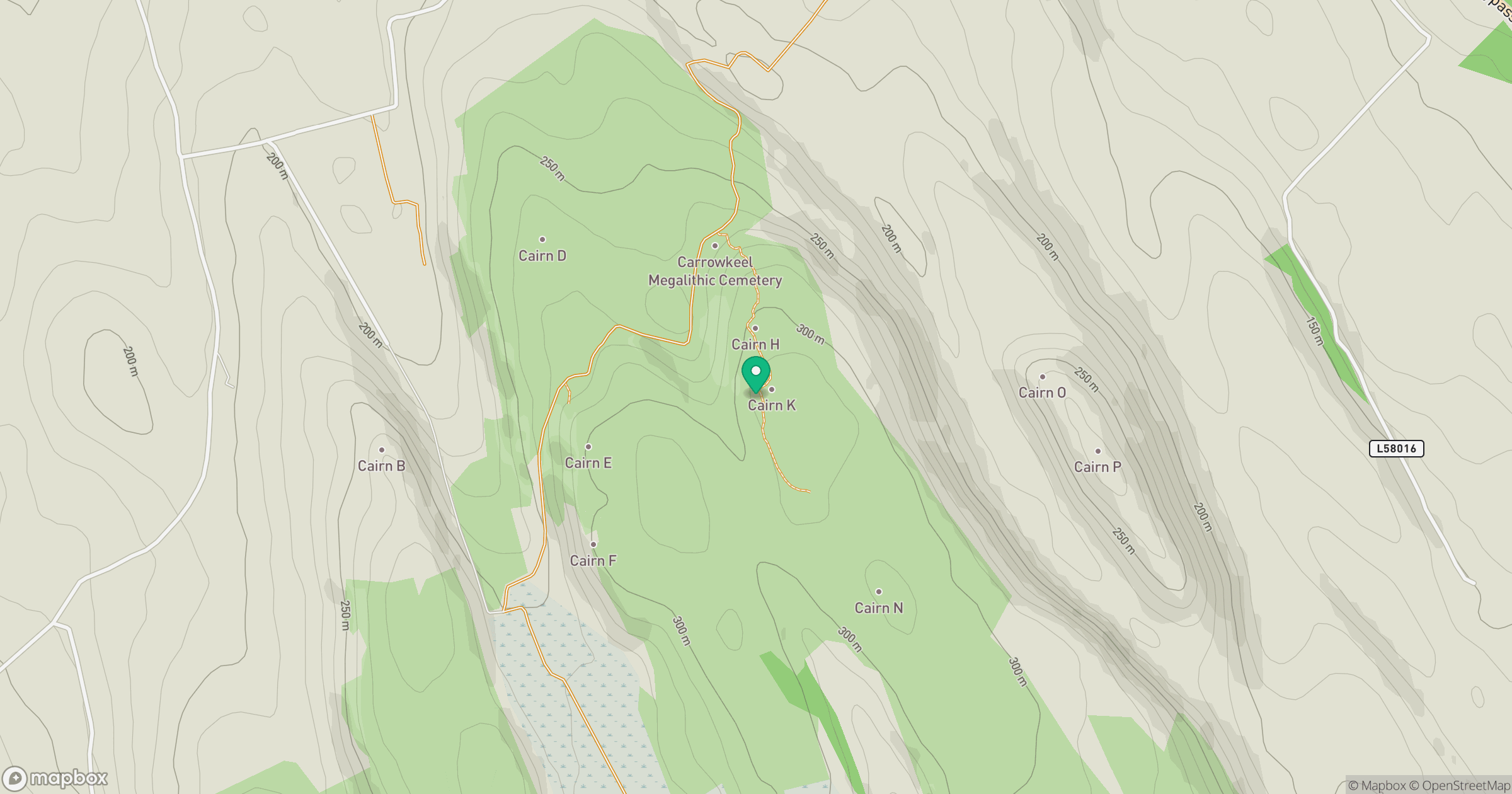
Grid reference: G753117
View on OpenStreetMapOpens a map in a new tab, centred on the hill.
No comments yet. Be the first.